The Global Positioning System, or GPS, is now a big part of our lives. It changes how we find our way, locate ourselves, and get important location data. It all started with a simple idea from the first artificial satellite, Sputnik, in 1957. This idea led to the first global satellite navigation system, Transit, made by Johns Hopkins University in the 1950s and 1960s.
The need for exact location data grew for uses like tracking submarines and ships. The Aerospace Corporation was key in making GPS better. They used Transit’s success as a starting point for today’s GPS.
Key Takeaways
- The invention of GPS was driven by the need for highly precise location data for military and civilian applications.
- The Aerospace Corporation played a pivotal role in advancing the concept and technology of GPS, building upon the foundation of the Transit system.
- GPS operates by measuring the precise time of signals transmitted by satellites and received by devices on the ground, enabling accurate location calculations.
- Gladys West, a pioneering mathematician and computer programmer, made significant contributions to understanding Earth’s gravitational fields and calculating its shape, crucial for the accurate functioning of GPS.
- The development of GPS technology has been a collaborative effort, involving military initiatives, academic research, and private sector innovation.
The Origins of GPS: From Sputnik to Transit
The story of the Global Positioning System (GPS) starts with Sputnik, the first successful satellite, launched in 1957. At Johns Hopkins University’s Applied Physics Laboratory (APL), scientists noticed the Doppler effect on Sputnik’s radio signals. This allowed them to track the satellite’s path from the ground.
The Doppler Effect and Satellite Tracking
This finding led the APL team to a new idea. They wanted to use satellites to find a receiver’s location on Earth. By measuring the Doppler shift in the radio signals, they could pinpoint the receiver’s spot with great accuracy.
The Development of Transit: The World’s First Global Satellite Navigation System
The APL team then built the Transit system, the first global satellite navigation system. It started in the late 1950s and was ready by the mid-1960s. Transit helped both the military and civilians, like the Navy’s missile submarines. It made maps and charts much more accurate, changing how we navigate.
Transit was very accurate for its time, with an error of just 25 meters. But it had its limits, like needing a fixed receiver and not offering constant coverage. These issues led to the creation of the more advanced GPS we use today.
“Vice President Hubert Humphrey offered the use of Transit to the civilian community in 1967, marking a significant step towards the democratization of satellite navigation technology.”
The story of GPS begins with the work of scientists at the Applied Physics Laboratory. They used the Doppler effect and satellite tracking to make Transit, the first global satellite navigation system. This technology is the base of the GPS we depend on today, changing how we navigate the world.
Advancing GPS Innovation: The Aerospace Corporation’s Role
The Aerospace Corporation was key in improving GPS technology. In 1963, Dr. Ivan Getting, the corporation’s first president, wanted a better satellite navigation system. This led to Project 621B.
Aerospace engineers then made the system better. They suggested using four satellites to make the system more affordable. This was because it wouldn’t need high-accuracy clocks in receivers.
Project 621B and the Concept of Satellite-Based Navigation
Project 621B was a major step towards today’s GPS. Aerospace engineers worked hard to make satellite navigation work. They wanted to give users accurate and reliable information.
Their work helped GPS become popular in many fields. It changed how we use technology today.
The Importance of Atomic Clocks and Timation
Atomic clocks at the Naval Research Laboratory’s Naval Center for Space Technology were also crucial. Timation, the technology they developed, made GPS more accurate. It also allowed for three-dimensional location coverage.
Atomic clocks were key for precise timing. This was essential for GPS to work well. It helped users get accurate positions.
| Key Milestones in GPS Innovation | Contribution |
|---|---|
| 1963: Project 621B | Developed by the Aerospace Corporation, this project laid the foundation for satellite-based navigation. |
| 1970s: Timation | The Naval Research Laboratory’s development of atomic clocks and the Timation system enhanced the accuracy and capabilities of satellite-based navigation. |
| 1993: GPS Constellation | The GPS system became fully operational with 24 satellites, providing Standard Positioning Services (SPS) for civilian use. |

“The Aerospace Corporation’s visionary leadership and innovative engineering played a crucial role in shaping the future of satellite-based navigation, laying the groundwork for the GPS system we rely on today.”
The Birth of Navstar: The Modern GPS System
In the early 1970s, the United States Department of Defense wanted a better satellite navigation system. Col. Bradford Parkinson was in charge of this important project. He led a team of skilled engineers and scientists to combine the best of Transit, Timation, and Project 621-B.
This team’s work was the start of the Navstar program, the main part of the Global Positioning System (GPS). In 1973, the Defense Department gave the green light to Navstar. This was a big step towards creating this groundbreaking technology.
The first Navstar/GPS satellite was launched in 1978. This was the beginning of the GPS system we use today. The satellites, with their atomic clocks, have changed how we navigate and communicate. They help in many areas, like farming and studying climate change.
“The development of the Navstar GPS system was a groundbreaking achievement that has had a profound impact on our lives. Col. Bradford Parkinson’s vision and leadership were instrumental in bringing this technology to fruition.”
The GPS system keeps getting better, with newer satellites and more accuracy. Its impact on our daily lives will only grow. The Navstar program shows how innovation and teamwork can lead to great achievements.
The Invention of GPS: How Satellite Navigation Transformed Travel and Communication
The Global Positioning System (GPS) has changed how we navigate and communicate. It was first made for the military but now helps us every day. It affects travel, farming, emergency services, and even money transactions.
The story of GPS starts with the Cold War. The Soviet Sputnik launch in 1957 led to a race for satellite navigation. The U.S. funded projects like 621B and Timation to create accurate navigation systems.
In 1983, President Reagan made GPS data available to everyone. This was after a Korean Air Boeing 747 was shot down by the Soviet Union. This move made GPS useful for everyone, changing travel and communication forever.
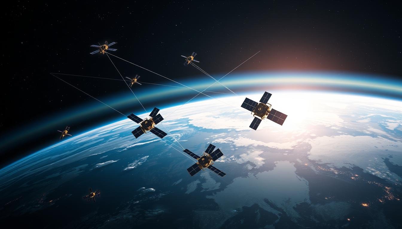
Now, over 30 GPS satellites orbit the Earth at 20,200 kilometers (12,550 miles) high. They have atomic clocks and are watched over by stations on Earth. This keeps the system working all the time.
| GPS Accuracy | Horizontal | Vertical |
|---|---|---|
| 95% Accuracy | ~10 meters | ~20 meters |
The GPS User Segment includes devices like smartphones and car GPS. These devices use GPS to help us find our way and stay connected. It’s made traveling and talking to others much easier.

GPS is getting even better with new systems like Galileo, GLONASS, and BeiDou. Its impact on our world is huge. As GPS keeps improving, it will keep changing how we live and work.
GPS and National Security: Civilian Use and Selective Availability
As GPS technology spread, the U.S. government worried that enemies could use it against them. They started “selective availability,” making GPS less accurate for non-military use. But in 2000, they ended this, making GPS much more accurate for everyone.
The Proliferation of GPS in Consumer Products
With better GPS and cheaper technology, GPS became a big part of our lives. Now, smartphones, cars, and many industries use GPS. It has changed how we move, track, and talk to each other.
| GPS Accuracy in Consumer Products | Accuracy |
|---|---|
| GPS-enabled smartphones | Typically accurate to within a 4.9m (16 ft.) radius under open sky |
| Government-provided GPS signals | Global average user range error (URE) of ≤2.0m (6.6 ft.), with actual URE often much better |
| Global average URE across all satellites (as of April 2021) | ≤0.643m (2.1 ft.) 95% of the time |
The End of Selective Availability and Increased Accuracy
In May 2000, President Bill Clinton ended Selective Availability. This made GPS much more accurate for everyone. It changed how we use GPS in our daily lives.
“The U.S. Space-Based Positioning, Navigation, and Timing Policy of December 8, 2004, established a permanent National Space-Based PNT Executive Committee (EXCOM) and provided guidance for various aspects related to the Global Positioning System (GPS) and U.S. space-based systems.”
GPS in our daily lives has grown a lot. It has changed how we navigate, communicate, and interact. It has a big impact on many areas, from farming to emergency services. It keeps shaping our modern world.

The New GPS: Modernization and GPS III
The GPS system has grown a lot since it started. By the early 2000s, it was clear it needed an update. A plan was made to add new signals to satellites and start the GPS III program.
The first GPS III satellite launched in 2018 on a SpaceX Falcon 9 rocket. More satellites followed on Falcon 9 and ULA Delta IV rockets. By 2023, all GPS III satellites will be launched, completing the modernization.
The GPS III satellites are more accurate and resistant to interference. They can last about 15 years and send the new L1C civil signal. This signal works with other global systems, making GPS III receivers much more accurate.
| Metric | Improvement |
|---|---|
| Accuracy | 3 times more accurate than previous models |
| Jam Resistance | 8 times more resistant to jamming than previous models |
| Lifespan | Designed to last around 15 years |
The GPS modernization program, including GPS III satellites, aims to keep GPS up to date. With new satellites and system upgrades, GPS’s future looks bright.
“GPS services have contributed more than $75 billion annually to the US economy.”
The GPS modernization and GPS III program bring many benefits. These include better accuracy, reliability, and resistance to interference. As GPS technology advances, we can expect even better location and navigation services, improving our daily lives.
GPS Applications: From Agriculture to Climate Change
GPS technology is used in many fields today. It helps in precision agriculture, power distribution, and studying climate change. This technology has changed how we interact with our world.
GPS in Agriculture and Construction
In farming, GPS helps tractors and equipment work better. Farmers use it to place seeds, water, and pesticides exactly where needed. This makes crops grow better and saves resources.
In construction, GPS is key for surveying and making digital blueprints. It also helps find the right spots for building parts.
GPS in Power Distribution and Climate Studies
GPS is also important for power systems. It helps keep generators in sync to avoid power outages. For climate studies, GPS-based reflectometry measures changes in snow, plants, ice, and soil. This helps scientists understand climate change better.
| GPS Application | Key Benefits |
|---|---|
| Agriculture | Precision farming, targeted seeding, watering, and pesticide application |
| Construction | Surveying, digital blueprints, and locating structural elements |
| Power Distribution | Synchronizing generators and preventing blackouts |
| Climate Studies | Measuring changes in snowfall, vegetation, ice coverage, and soil moisture |
GPS has changed many industries for the better. It makes things more efficient and helps us discover new things. As GPS gets better, we’ll see even more cool uses in the future.
GPS Vulnerabilities: Threats and the Need for Backup Systems
GPS is a vital tool worldwide, but it faces many threats. The U.S. Space Force manages 32 satellites that send GPS signals. These signals are crucial for over 900 million receivers in the U.S. However, these satellites can be damaged by storms or attacks, cutting off GPS signals.
Hacking and spoofing are also big concerns. These attacks can alter GPS signals, giving false information. This could lead to serious problems.
The impact of GPS disruptions could be huge. Over 100 million cars in the U.S. use GPS, and 7,600 commercial planes rely on it. Since its start, GPS has brought America around $1.7 trillion in benefits. Yet, the U.S. government has not funded backup systems yet.
- The U.S. risks losing its lead in PNT without a solid plan to use multiple systems.
- The Space-based PNT Advisory Board says GPS is more at risk of jamming and spoofing than other systems.
- The military depends on GPS for many tasks, making it key for national security.
Work is being done to update GPS and mix it with other systems. But, the U.S. needs to invest in backup systems and improve cybersecurity. Working with allies and partners is also crucial for PNT security.
The economic effects of GPS misuse, like spoofing, are hard to fully grasp but could be very costly.
Conclusion: The Lasting Impact of GPS on Modern Life
The Global Positioning System (GPS) has changed our world a lot. It has improved transportation, communication, agriculture, and climate science. Since it started, GPS has brought the U.S. about $1.4 trillion in benefits, a study found.
Now, GPS is a big part of our daily lives. Over 900 million GPS devices are used in the U.S. every day. This shows how much we rely on it.
GPS keeps getting better and is used more and more. But, we need a strong and reliable system. The U.S. could lose $1 billion a day if GPS fails. This shows how important it is to keep GPS safe and working well.
The evolution of GPS has changed travel and communication a lot. It has also helped global economies grow. Businesses can now expand and work better because of GPS. This has helped them make more money and grow the economy.